SERVICES
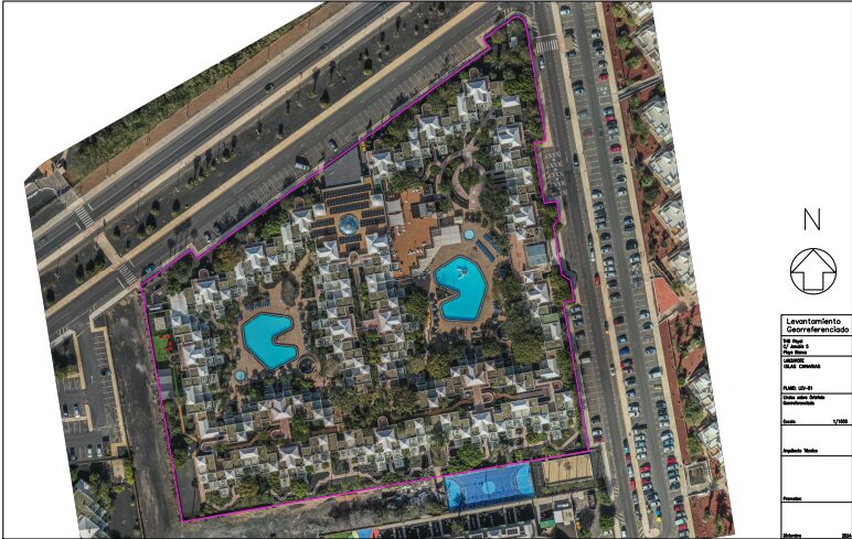
Georeferenced orthophotos
Aerial images with cartographic accuracy
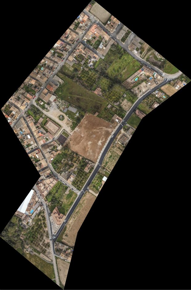
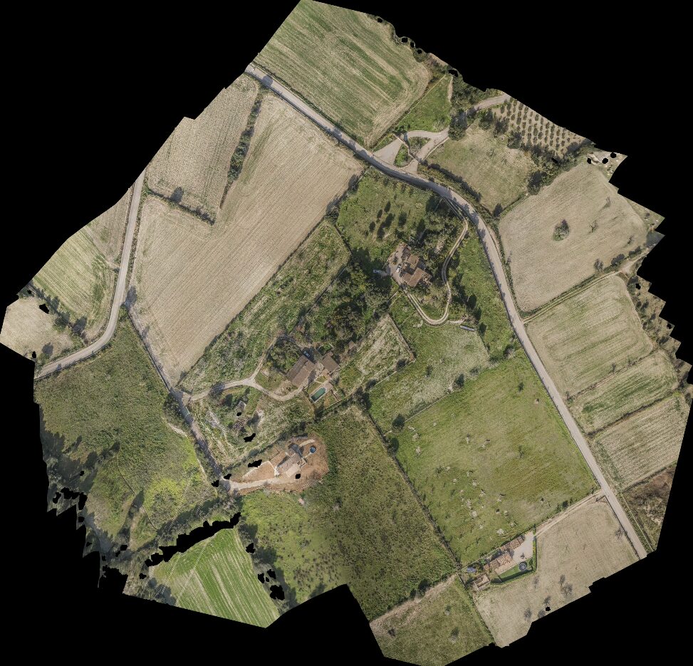
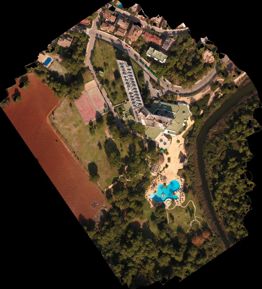
An orthophoto is an aerial image that has been geometrically corrected to eliminate distortions caused by perspective, terrain relief, and camera tilt. The result is an image with map-like accuracy, where each point has a precise location in real-world coordinates, allowing for the accurate measurement of distances and areas, just like a plan.
They combine the wealth of information from an aerial photograph with the metric precision of a map, enabling detailed measurements and terrain analysis.
They are commonly used for cartography, urban planning, environmental impact studies, and other work requiring high precision.
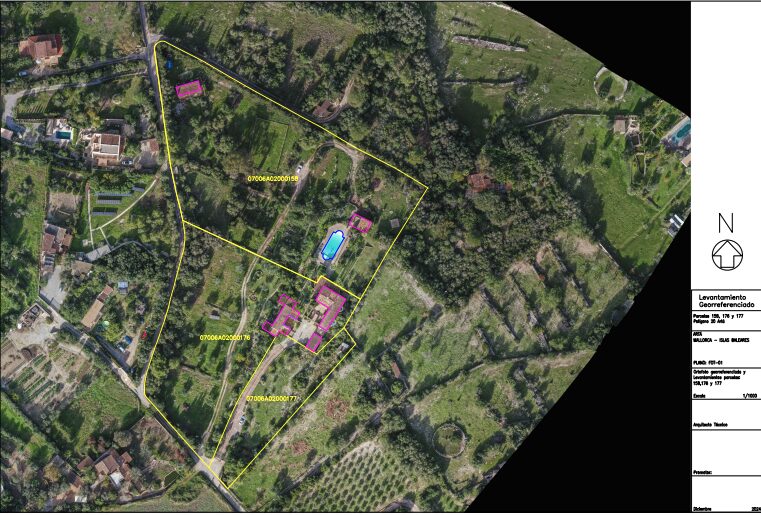
From a georeferenced orthophoto, we can draw property boundaries, the dimensions of a building, etc., generating a topographic map of the property or surface with the same precision as if it were created by taking points on the ground with a professional GPS. This adds more value than a plan with black lines on a white background, since the entire property is “visible” here.